Updates to 'Shaping Our City' Interactive Map
A visual guide to projects in review across Planning, Design Review, and Zoning Boards
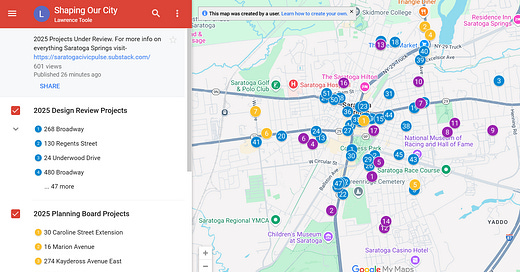
We recently launched the “Shaping Our City” Interactive Map, which gives you real-time insight into projects reviewed by the Saratoga Springs Planning Board, Design Review Commission, and Zoning Board of Appeals.
We’re using AI to help make this possible — first by generating meeting minutes from all the public meetings, and then by automating the extraction of project-specific updates. These updates are integrated with Google Maps so you can visually explore what’s happening where.
What's on the Map?
The map is organized into three layers:
Design Review projects
Planning Board projects
Zoning Board projects
Thanks to your feedback, we’ve fine-tuned what data we show. Each project pin now includes:
• Property address
• Meeting type
• Meeting date
• Project description
• Board decision
• Public comment summary
• Public comment status
In each map layer’s legend, projects are listed from most recent to oldest, so you can instantly see what’s new. If a project was talked about at an earlier meeting and is then discussed at the next meeting, the map always shows most recent status.
Stay Informed, Stay Involved
If a project is still under review and no final board decision has been made, we include public comment summaries and indicate whether there’s still an opportunity to share your input at an upcoming meeting.
We’ll continue updating the map as new meetings are held throughout the year. As always, the most current projects will appear at the top of each list.


